Urapuntja Homelands (Utopia)

Homelands allow traditional owners to live on country, to be close to sacred sites, burial places, dreaming trails, and gather traditional bush tucker and bush medicine.
The Utopia homelands was formed in the late 1970s in the Northern Territory and is made up of 17 communities. These communities are separated by rough, corrugated dirt roads and in some cases by the dry and sandy river bed of the Sandover River.
The most central community is Arlparra, where our offices are located, on the eastern perimeter of the Western Desert adjacent to the traditional land of the Eastern Anmatyarre and Alyawarr people.
Traditional Ceremony and Customs
Homelands enable people to maintain their language, customs and cultural practices, and fulfill their spiritual and cultural responsibilities to take care of sacred sites and country. English is not the first or second language on many of the homelands.
Please respect ceremony time and refrain from travelling on the roads. If visiting, please respect custom and traditional ways on Urapuntja homelands, including modesty in clothing and ensuring that you comply with no alcohol permitted.
Land Permits
Non-residents and visitors to Urapuntja are required by law to hold a written land permit to visit and stay here. To apply for a land permit: go to Central Land Council at www.clc.org.au/permits/
Road Access
Access to the Urapuntja Homelands is by road mostly on unsealed roads on the Sandover Highway. Drivers need to exercise caution driving on these roads, given these are unsealed roads and wildlife often are crossing unexpectedly. Urapuntja has a large number of brumby horses, donkeys, cattle, birdlife and other wildlife.
The trip takes approximately 3.5 hours to 4 hours from Alice Springs in dry conditions, firstly on the sealed Stuart Highway, then the sealed Plenty Highway, before transitioning onto the unsealed Sandover Highway.
A four-wheel-drive vehicle is required to make the journey after rain. Heavy rains will close the roads. Road travel should be avoided between sunset and dawn when visibility is poor and animals, may be resting on or near the road.
WIFI Hotspot and Computer Room at Urapuntja Homelands Centre
Located at Arlparra, WiFi hotspot and computer room have been set up and operated by the Urapuntja Aboriginal Corporation through the Urapuntja Homelands Centre. This is within walking distance of our offices, the maintenance depot, and the arts centre.
Cellphone Network Coverage
Many of the Urapuntja homelands, outside of Arlparra, do not have cellphone network coverage or Internet connectivity. The digital divide is a reality here. We have been able to set up Wifi hotspot and computer room at the Urapuntja Homelands Centre in Arlparra. Telstra and satellite phones are the only cellphone network that work in the remote homelands and communities.
Weather
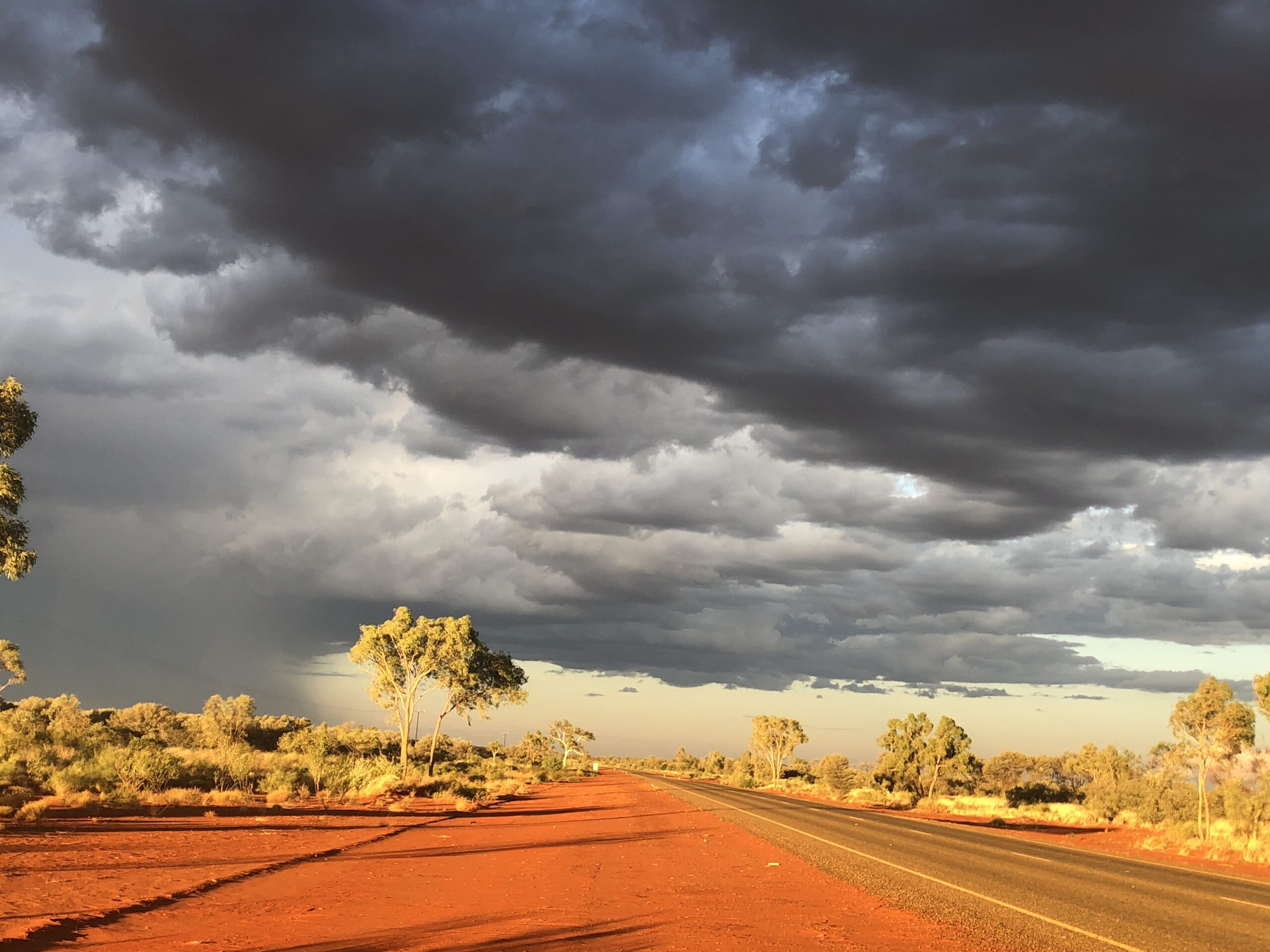
The Urapuntja Homelands have an extreme desert climate. The summer is hot with temperatures often exceeding forty degrees celsius. In winter the nights are cold, often sub-zero and frosts occur from June to August. After the (infrequent) rain the desert landscape is transformed. The dried out spinifex flowers can resemble a field of wheat and the Mulga shrub bears green dense foliage and masses of bright yellow flowers. Growing among these plants is an abundance of wildflowers that turns the deep red coloured desert floor into a Utopian garden.
Urapuntja Homelands History
Urapuntja Homelands (Utopia homelands) is one of the earliest communities created in the early Land Right days of the late 1970’s by local activism. It was claimed by local Aboriginal families who were never fully dispossessed. Although it has a white history of pastoral activity, these homelands were never previously a government settlement or mission.
We have expressly distanced ourselves from a central residential hub. Instead we have established 16 individual homelands within the greater area that recognise traditional family areas.

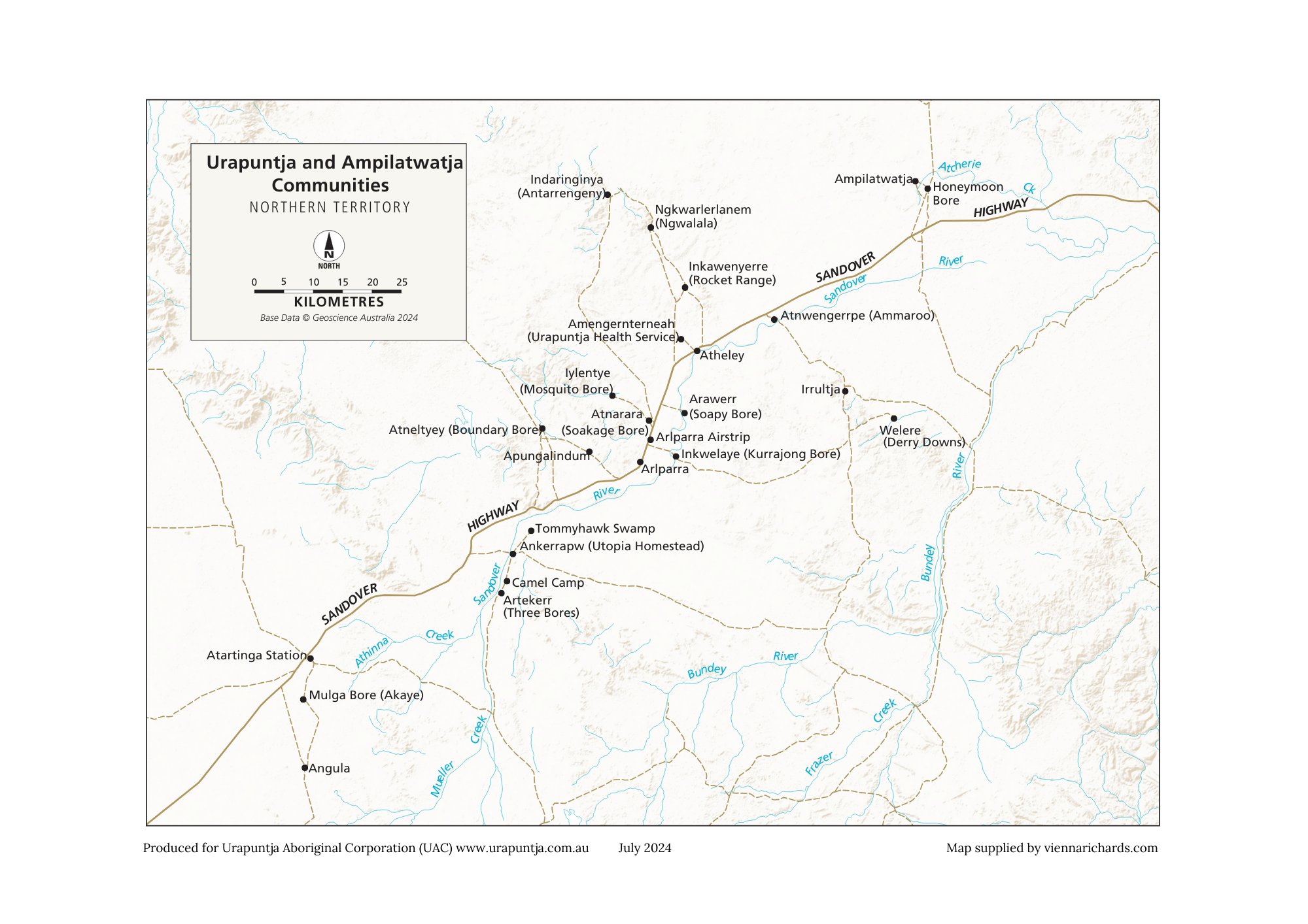
Location of Urapuntja Homelands
Note: many of the Urapuntja homelands (Utopia) are not identifiable or available on Google Maps.

Across vast tracts of remote lands of the Alyawarr and Angarapa Aboriginal Land Trust, the homelands span across 3250 square kilometres.
We represent and advocate for the homeland residents, who numbered 600 to 1000 strong, living in:
- Indaringinya (Antarrengeny)
- Ngkwarlerlanem (Ngwalala)
- Inkawenyerre (Rocket Range)
- Amengernterneah (Urapuntja Health Service)
- Atheley
- Arawerr (Soapy Bore)
- Atnarara (Soakage Bore)
- Iylentye (Mosquito Bore)
- Arlparra
- Inkwelaye (Kurrajong Bore)
- Apungalindum
- Atneltyey (Boundary Bore)
- Tommyhawk Swamp
- Ankerrapw (Utopia Homestead)
- Camel Camp
- Artekerr (Three Bores).
There are six outer homelands and communities serviced by the Urapuntja Aboriginal Corporation (UAC):
- Mulga Bore
- Angula
- Irrultja
- Honeymoon Bore
- Welere (Derry Downs)
- Atnwengerrpe (Ammaroo).
